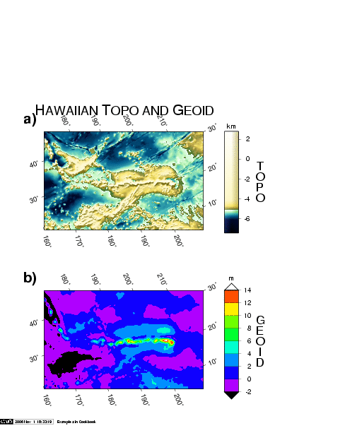
Example 2. Images of bathymetry and the marine geoid in the region surrounding the
Hawaiian Islands. The two images are oblique Mercator projections of data
sampled on a geographical grid. The data were extracted from global data sets
available from the National Geophysical Data Center in Boulder, CO. Separate
calls to grdimage and psscale created the composite illustration.