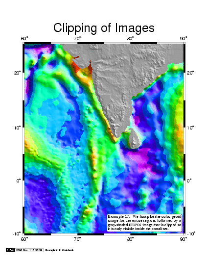
Example 17. It is often difficult to blend two different gridded
data sets on one map. A soltion is to use coastline clipping.
Here, a geoid grid is imaged in color, before pscoast is used to
initiate clipping, followed by a grayshaded topotgraphy. Note that
both images fill the entire map, but the coastline clipping only
lets the images show where we want them to be valid.